The pandemic kept me grounded for a long while, and during that time I’d been reflecting on some of my favorite flights. A few months back, Roger put out a call for articles, and I thought “why not?” I know I’m always looking for new destinations to try out. Maybe others are, too. If so, I hope this proves inspiring to someone.
This flight happens to be one for which I actually have a few pictures. I’m no shutterbug, so this is a rare occurrence!
It was the 4th of July, 2019. My wife and son were already on vacation — they took two weeks but I could only take one — and I needed an adventure. My intention was to do a flight someplace farther afield than I normally would go, do some hiking, and come home. So I’d reserved the plane for the day and had done some planning.
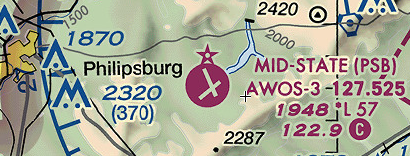
My plan was to fly to Mid-State airport in Philipsburg, Pennsylvania (KPSB). We’d driven by it in the past, so I knew that it was right next to Black Moshannon State Park (don’t ask me what a “moshannon” is or how it could be blackened, I have no idea), and I thought it would be a great destination for a fly-and-hike day trip. There are trails that start right on the airport’s driveway and lead around a lake. Seemed perfect… right up until the night before.
The weather forecast was for hot, humid weather all over central PA, with a strong possibility for pop-up thunderstorms. I may not be the world’s most experienced pilot, but I still know enough to stay away from t-storms like they’re anti-mask COVID patients. Actually, if I remember correctly, official FAA guidance says the 6-foot social distancing guideline isn’t going to cut it when it comes to convective activity. I felt like I could probably see and avoid the cells, but it felt like too much risk. Besides, the flight would be hot, bumpy, and uncomfortable, and that all adds up to “not a whole lot of fun” in my book. So Mid-State was out.
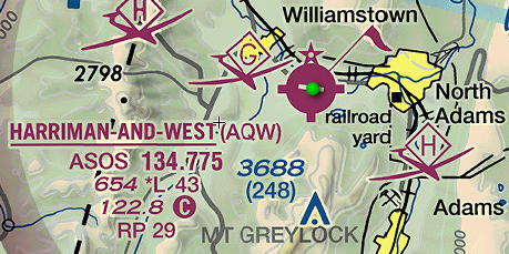
Once I got over the disappointment of having to scrub the flight, I started thinking about other possible destinations for a similar fly-and-hike adventure. I googled ‘airports with nearby hiking trails’ and found several suggestions, but the one that seemed best was Harriman-and-West (KAQW), located midway between Williamstown and North Adams, Massachusetts. In the northwest corner of the state, it’s a similar distance to Philipsburg (145 nm vs. 160 nm), and the forecast was far better in that direction. Best of all, it’s only a mile from the Appalachian Trail (“AT”) and the route up Mt. Greylock, the highest point in the state of Massachusetts and site of a memorial tower with some reportedly fantastic views.
Another attraction, for those who are fans, is that Mount Greylock is the supposed location of Ilvermorny, the North American school of witchcraft and wizardry in the Harry Potter universe (a.k.a. the ‘Murican Hogwarts). Watch for brooms on short final.
So I worked out a new flight plan and headed to the airport to preflight and load up 642SP, my trusty steed for the day.
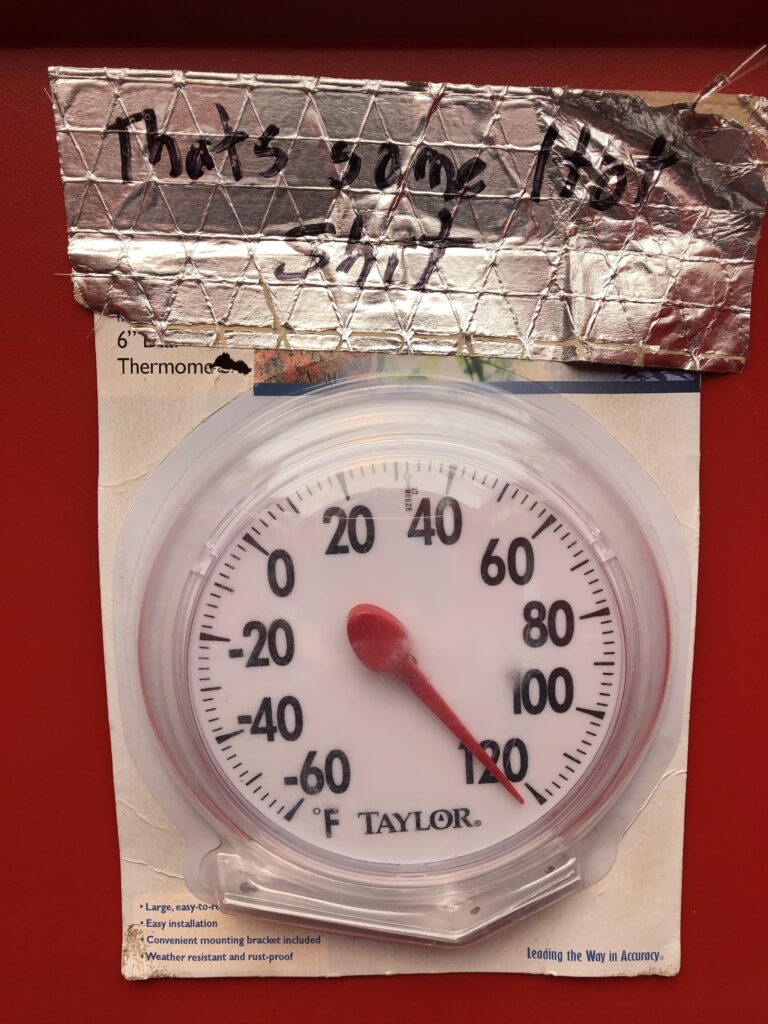
The day was hot. I was leaving mid-morning and it was already into the 90s. Thankfully, it was just me and some basic gear — a backpack with my lunch, some water, and a change of clothes — so the density altitude wasn’t going to prevent me from getting off the ground. I was soon airborne and winging my way north.
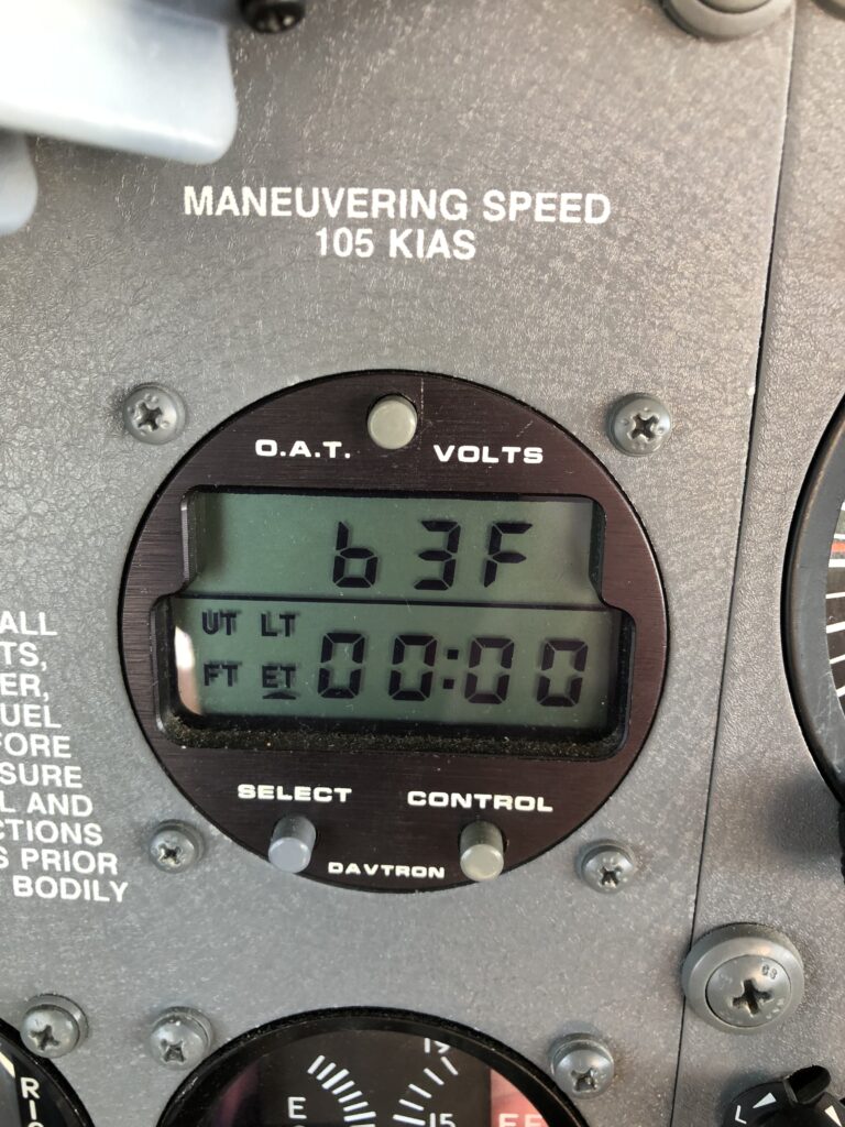
The plan was to follow V249 north to Albany (I wanted to practice following VOR radials), then make a right turn direct to AQW, and it went without a hitch. The controllers at Albany weren’t very busy but were still very efficient, although I think they thought I was crazy to not want direct routing. But honestly, aside from practicing VOR tracking, I was just enjoying the longer time at altitude, where the temperature was a nice, cool 63. The air coming through the vents felt great and I knew I should soak up as much of it as I could while I had the chance.
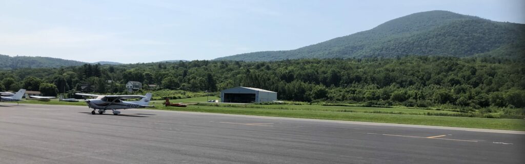
Safely on the ground, the quest for the restroom began. There was no FBO per se (one was clearly under construction), but I eventually found one: there was an office space used by an aerial photography company that was nice enough to let me use their facilities.

Relieved, washed up, and with my pack shouldered, I was off to find the trailhead. It’s a mile from the airport and through a neighborhood. There is a “back entrance” from the airport that would have been a shortcut, but it’s security-gated and I didn’t have the code, so I had to walk all the way around. But it’s a nice neighborhood and I had a pleasant stroll, despite the still-rising temperatures. One interesting thing about this neighborhood — and the ethos surrounding the AT — was that someone had put a rack of bikes in their front yard for hikers to borrow for a quicker ride into town. There was no lock, no payment drop-box; just a sign asking that the hikers bring them back when they’re done so others can use them, and AT hikers are the kinds of people that will honor that. Amazing!
From the trailhead, it was a fairly steep hike through some deep woods. The trail was pretty clearly-marked, but I’ll admit I got turned around at one point: the trail crossed a road and I couldn’t see where it continued on the other side. I wandered around for quite a bit before I finally found it again. Note to self: better maps next time.
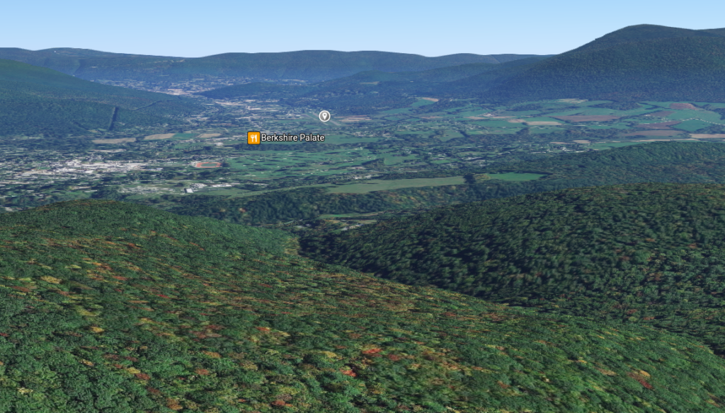
After several miles of slogging and around lunchtime, I stumbled onto a fantastic vista of the valley. That’s where I stopped for lunch:
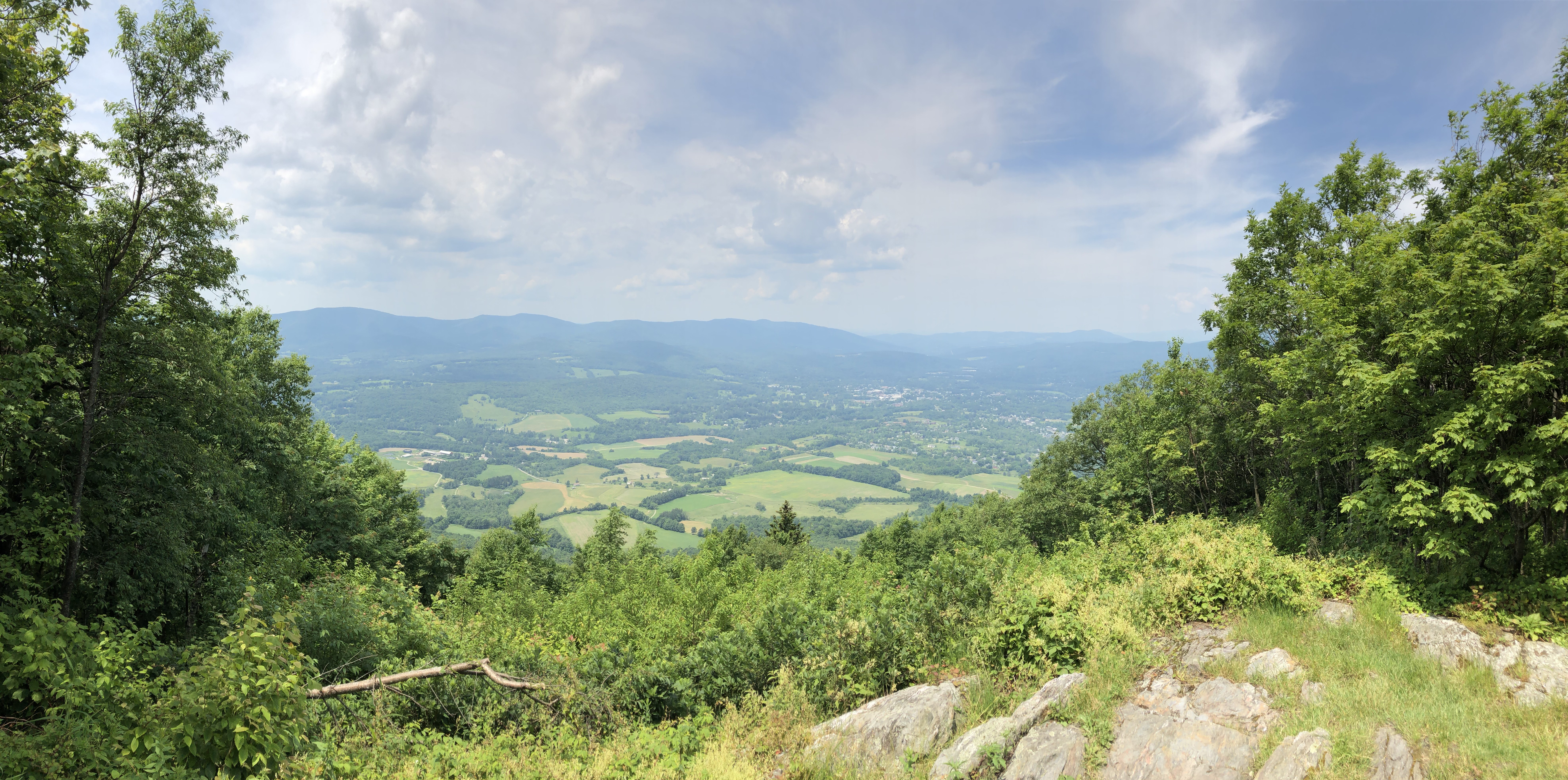
At this point, I was about halfway to the summit of Mt. Greylock — I’d gone 3 or 4 miles, and still had another 3 or 4 to go. It was already early afternoon. It was hot. I was running out of water. I was tired. And I still had to get back to the airport, re-fuel, re-preflight, fly home, re-re-fuel, and secure the plane. Plus, my dog was still waiting for me at home, alone, and probably already had her legs crossed. I decided it was time to start my descent. Sightseeing at a non-existent magic school would have to wait for another day.
The return hike was fairly uneventful, aside from getting passed by an AT thru-hiker (you can always tell the thru-hikers; you tend to be able to smell them coming) and a quick stop at a grocery store for some cold iced tea (I was completely out of water by then, and iced tea never tasted so good!).
By this point, I needed to find a restroom again, but that aerial photography office was closed up and locked. Luckily, the construction site had a port-a-potty, with some… interesting commentary (did I mention the day was HOT?).
I changed into my dry clothes, readied the plane, and headed home.
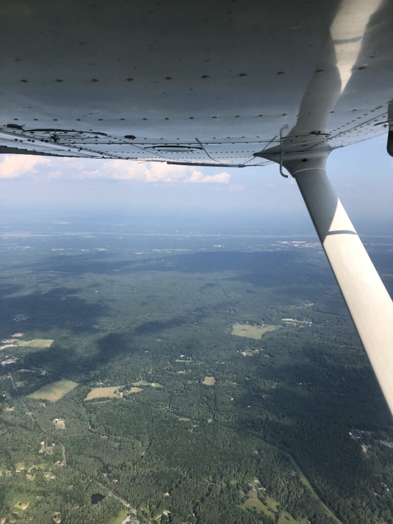
Hudson to the left of me… 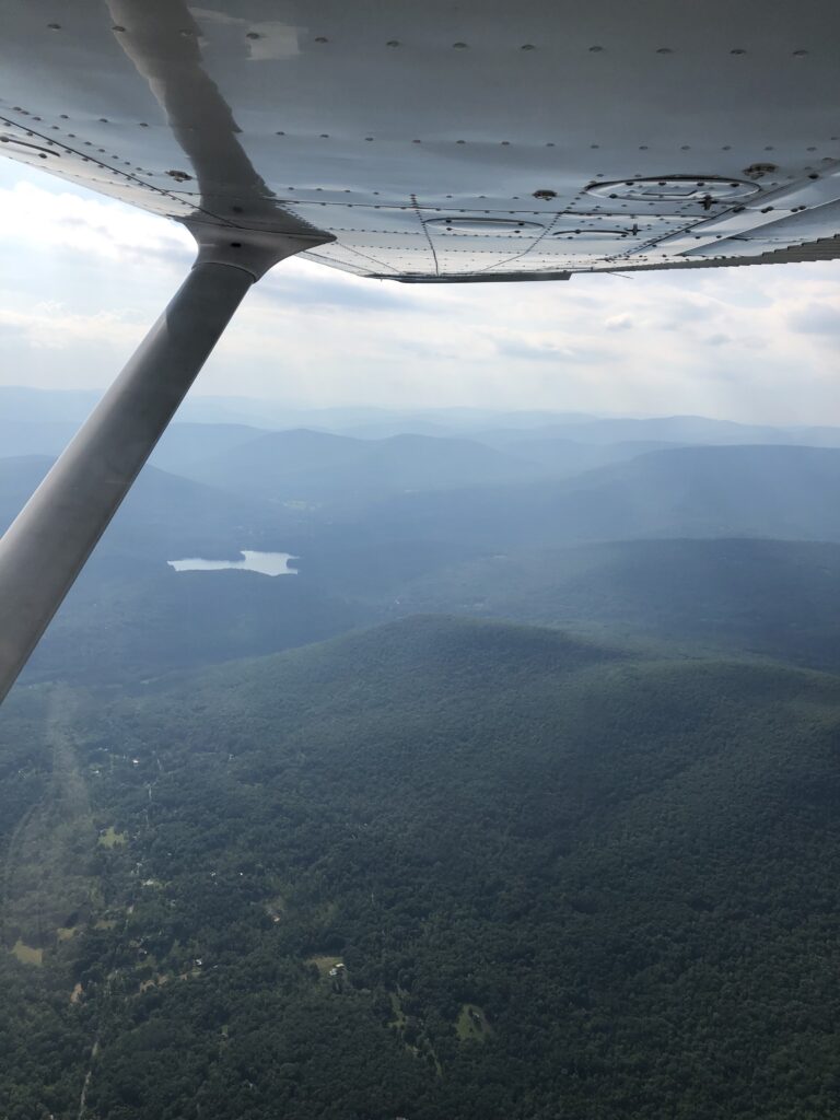
…Catskills to the right…
Back on the ground in NJ, the plane secured and ready for the next adventurer, I took a few moments to reflect before I headed home. I was tired, yes. I was thirsty and hungry, sure. I badly needed a shower. But I was ecstatic. I’d just done in a single day what most people would need a whole weekend to do: head up to northwestern MA, go for an 8-mile hike in beautiful mountains, and come home again. It still feels to me like a minor miracle that I get to do this — just jump in a plane and go wherever I want to (and the weather will let me, of course). I’d been on this huge adventure far from home, and then went back to work the next day like nothing ever happened. It felt — and still feels — like we pilots get to have these amazing secrets: we get to go places and have these adventures, see and do things that nobody else does, and nobody else even knows we’ve done it!
Well… until I write up an article like this and spill the beans, that is.
For the privilege to create and have these adventure-secrets, I’m incredibly grateful. COVID has made me realize just how precious this privilege really is. Time and money are still always limiting factors, but you have to appreciate all the chances we get.
So… who’s up for a hike?
Awesome post Eric!! What a great trip. And – thanks for taking the time to put this together.
To other Blue Sky members…. you can do this too. It’s open to anybody. Try it. If you need or want help figuring it out, ask Eric (haha). Or me or Steve Timko.